
Maps are a major resource when researching history of any place. Online Maps, while lacking the touch of a printed map, offer zoom, scaling, and sometimes search features to facilitate using the map. There are many kinds of maps. Most maps show political divisions (country, state/province, county, township, etc.). There are specialty maps that focus on an aspect of the location; Topographical maps, Road, Railroad, River maps are common. While we are most familiar with sheet maps, maps bound in books and atlases present a collection of maps.
The Delaware County Historical Society’s Cryder Research Library collection includes maps and atlas books along with directories for both Delaware City and Rural areas. The Society’s Online Catalog lets you search for available resources, for example Search for Maps. Visitors are welcomed to the Library, during open hours, view and research with our maps and other resources.
In our research, our volunteers have found Online other Maps of Ohio, Delaware County, and places in the county. To assist our members, friends, and visitors we offer this page of online maps that we found useful.
Delaware County Ohio Maps
Library of Congress
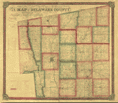
Townships, Landowners, Includes a list of voters in Delaware County.
Delaware, Delaware County, Ohio Sanborn Fire Insurance Maps
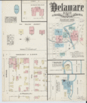
1885 – Sanborn Fire Insurance Map from Delaware, Delaware County, Ohio
Library of Congress
Feb 1885. Five Images.
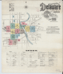
1890 Sanborn Fire Insurance Map from Delaware, Delaware County, Ohio
Library of Congress
Oct 1890. Eight Images.
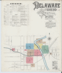
1895 Sanborn Fire Insurance Map from Delaware, Delaware County, Ohio
Library of Congress
Oct 1895. Fifteen Images.
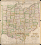
Ohio State Maps
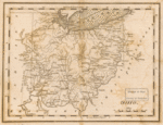
1814 Ohio – Carey’s American Pocket Atlas
Library of Congress
From: Carey’s American pocket atlas. Philadelphia: Mathew Carey, 1814.
1814 Ohio – Hough, Bourne, & Melish
Library of Congress
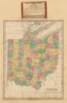
1820 Ohio – American Antiquarian Society
Library of Congress
Shows counties, major roads, and important settlements in each county, including the Black Swamp of NW Ohio and the Unbroken Sandstone Region in SE Ohio.
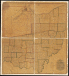
1840 Ohio – Lewis Robinson & Co
Library of Congress
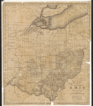
Ohio–Administrative and political divisions, Canals
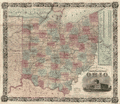
Library of Congress
Hand-colored. Table of “Census of the State of Ohio” 1840,1850.
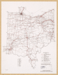
Ohio Transportation Maps
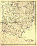
Library of Congress
Map shows county boundaries, cities and towns, and the railroad network with names of lines along the railroads.
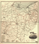
Library of Congress
Shows counties, cities and towns, railroad network with named lines, and a list of “Railways operating in Ohio” and “Electric railways operating in Ohio.”
Library of Congress
Shows transportation zones, trackage rights, principal stations, distances between rail intersections, major U.S., Interstate, and State highways, and navigable waterways. Includes “Index to railroads.”
About the Source
Map Collections of the Library of Congress The Geography and Map Division (G & M) has custody of the largest and most comprehensive cartographic collection in the world with collections numbering over 5.5 million maps, 80,000 atlases, 6,000 reference works, over 500 globes, and globe gores, 3,000 raised relief models, and a large number of cartographic materials in other formats, including over 19,000 CDs/DVDs. The online Map Collections represents only a small fraction that has been converted to digital form.